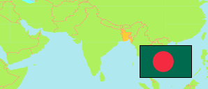
Bandarban
District in Bangladesh
Contents: Subdivision
The population development in Bandarban as well as related information and services (Wikipedia, Google, images).
| Name | Status | Transcription | Native | Population Census 1991-03-13 | Population Census 2001-01-22 | Population Census 2011-03-15 | Population Census 2022-06-14 | |
|---|---|---|---|---|---|---|---|---|
| Bandarban | District | Bāndarabāna | বান্দরবান জেলা | 230,569 | 298,120 | 388,335 | 481,106 | |
| Alikadam | Subdistrict | Ālīkadama | আলীকদম উপজেলা | 24,782 | 35,264 | 49,317 | 63,799 | → |
| Bandarban Sadar | Subdistrict | Bāndarabāna Sadara | বান্দরবান সদর উপজেলা | 49,711 | 68,693 | 88,282 | 111,096 | → |
| Lama | Subdistrict | Lāmā | লামা উপজেলা | 64,717 | 78,488 | 108,995 | 139,681 | → |
| Naikhongchhari | Subdistrict | Nāikṣyaṁchaṛi | নাইক্ষ্যংছড়ি উপজেলা | 38,350 | 49,465 | 61,788 | 76,475 | → |
| Rowangchhari | Subdistrict | Rōẏāṁchaṛi | রোয়াংছড়ি উপজেলা | 17,904 | 22,629 | 27,264 | 27,719 | → |
| Ruma | Subdistrict | Rumā | রুমা উপজেলা | 19,001 | 26,589 | 29,098 | 32,533 | → |
| Thanchi | Subdistrict | Thānaci | থানচি উপজেলা | 16,104 | 16,992 | 23,591 | 29,790 | → |
| Bangladesh | People's Republic | Bā̃lādēśa | বাংলাদেশ | 106,314,992 | 124,355,263 | 144,043,697 | 165,158,616 |
Source: Bangladesh Bureau of Statistics.
Explanation: The tabulated figures are not adjusted for underenumeration. 2022 subdistrict figures exclude hijra. Some area figures are derived from geospatial data.